Daily Weather Check
DAILY WEATHER BRIEFING
Global Incident Map, World Emergency Alerts
SELECT CURRENT CONDITIONS (click on location for detailed conditions)


Regional Radar Images
![]()
![]()
![]()
![]()
![]()
![]()
![]()
![]()
National Weather Service Radar - Composite Map


Severe Weather (Click on the map for details)

Lightning Activity (click for larger image)

Moisture Content
(click image for forecasts)

Weather Underground Home, Unisys Weather Home, NOAA Weather Home, Plymouth St. Weather Home, Accuweather Home, US Naval Observatory Data, NOAA Aviation Weather Center, Various NOAA Maps, Mid-Level Significant Weather, Regional Satellite images, Local Radar Images, UV Index Forecast, Precipitation Analysis, Aviation Weather Reports
FORECAST CONDITIONS

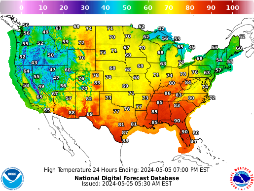
FORECAST HIGHS (click on map for other conditions)
National Air Quality Maps at airnow.gov

Current Surface & Near Surface Conditions


Current Winds Aloft


12hr Forecast


24hr Forecast


48hr Winds Aloft Forecast


72hr Winds Aloft Forecast


84hr Winds Aloft Forecast


Particles released or injected into the atmosphere, such as through a forest fire, volcanic eruption, chemical spill or even a nuclear attack, will be carried by the jet stream winds hundreds or even thousands of miles, depending on the size and weight of the particles, humidity, temperature and other weather factors. The images above show current and forecast winds for the two major currents which carry weather, and particles, across the U.S. The wind speed is indicated in nautical miles per hour, or knots, which is commonly used for aviation weather. The grid below shows the estimated times for particles, or fallout, to travel various distances based on the jet stream winds. Use the distance calculator link to calculate the distance between points.
|
| Distance |
| ETA in hours @ wind speed |
| ||||||
| Statute | Nautical | Kilometers | @ 40kts | @ 50kts | @ 60kts | @ 70kts | @ 80kts | @ 100kts | @ 120kts | @ 150kts |
| Miles | Miles |
|
|
|
|
|
|
|
|
|
| 100 | 87 | 161 | 2.2 | 1.7 | 1.4 | 1.2 | 1.1 | 0.9 | 0.7 | 0.6 |
| 200 | 174 | 322 | 4 | 3 | 3 | 2.5 | 2.2 | 1.7 | 1.4 | 1.2 |
| 300 | 261 | 483 | 7 | 5 | 4 | 4 | 3 | 3 | 2.2 | 1.7 |
| 400 | 348 | 644 | 9 | 7 | 6 | 5 | 4 | 3 | 3 | 2.3 |
| 500 | 434 | 805 | 11 | 9 | 7 | 6 | 5 | 4 | 4 | 3 |
| 750 | 652 | 1207 | 16 | 13 | 11 | 9 | 8 | 7 | 5 | 4 |
| 1000 | 869 | 1609 | 22 | 17 | 14 | 12 | 11 | 9 | 7 | 6 |
| 1250 | 1086 | 2012 | 27 | 22 | 18 | 16 | 14 | 11 | 9 | 7 |
| 1500 | 1303 | 2414 | 33 | 26 | 22 | 19 | 16 | 13 | 11 | 9 |
| 1750 | 1521 | 2816 | 38 | 30 | 25 | 22 | 19 | 15 | 13 | 10 |
| 2000 | 1738 | 3219 | 43 | 35 | 29 | 25 | 22 | 17 | 14 | 12 |
| 2250 | 1955 | 3621 | 49 | 39 | 33 | 28 | 24 | 20 | 16 | 13 |
| 2500 | 2172 | 4023 | 54 | 43 | 36 | 31 | 27 | 22 | 18 | 14 |
| 2750 | 2390 | 4426 | 60 | 48 | 40 | 34 | 30 | 24 | 20 | 16 |
| 3000 | 2607 | 4828 | 65 | 52 | 43 | 37 | 33 | 26 | 22 | 17 |
click on the desired region
Note the location of the nearest NWS office
Field Offices and more detailed explanations
The symbolic form of the forecasts is "DDff+TT" in which "DD" is the wind direction, "ff" the wind speed, and "TT" the temperature.
Wind direction is indicated in tens of degrees (two digits) with reference to true north, and wind speed is given in knots (two digits). Light and variable wind or wind speeds of less than 5 knots are expressed by "9900." Forecast wind speeds of 100 through 199 knots are indicated by subtracting 100 from the speed and adding 50 to the coded direction. For example, a forecast of 250 degrees, 145 knots, is encoded as 7545. Forecast wind speeds of 200 knots or greater are indicated as a forecast speed of 199 knots.
Temperature is indicated in degrees Celsius (two digits) and is preceded by the appropriate algebraic sign for the levels from 6,000 through 24,000 feet. Above 24,000 feet, the sign is omitted since temperatures are negative.
Weather History - 1871-2002, 2003-present
Distance Calculator (by place name or GPS Coordinate)
